Apartments Near WakeMed Raleigh: Commute Times and Wake County Schools
Verified October 2026 drive times from 2015 Wave Crest Drive to WakeMed, downtown Raleigh, NC State, RTP and RDU, what GoRaleigh's own route list does and does not establish at this address, and how Wake County base-school assignment, year-round calendars and reassignment actually work.
Where 2015 Wave Crest Drive sits relative to WakeMed and the rest of the Triangle
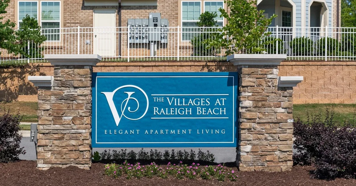
The Villages at Raleigh Beach is at 2015 Wave Crest Drive, Raleigh, NC 27610, off New Bern Avenue on the northeast side of the city. The WakeMed Raleigh Campus at 3000 New Bern Avenue is 2.87 miles away, and routing the pedestrian and road network with OpenStreetMap data on 6 October 2026 returns 6.5 minutes by car in free-flow conditions. That is the single most useful fact about this address for anyone whose work is at WakeMed, and it is the reason this article exists.
Everything else about the commuting picture flows from one piece of geography. This address sits east of I-440 and south of I-540, which puts it close to Raleigh's own institutions and far from the Triangle's western job centres. The drive to work is short if you work in Raleigh and long if you work in Research Triangle Park, Durham or Chapel Hill. There is no arrangement of back roads that changes that, and anyone evaluating this community for a western-Triangle job should price the difference in honestly before signing anything.
A note on what this place is called, because the sources disagree and all three are in use. The property feed describes the setting as Northeast Raleigh. OpenStreetMap files the surrounding streets under Wilders Grove. The large rental portals run a page called East Raleigh that covers the same ground. None of the three is wrong; they are simply different naming conventions, and a renter searching one will find listings filed under another.
The WakeMed Raleigh Campus commute is the short one
WakeMed's Raleigh Campus is the largest employer within a short drive of this address, and the 2.87-mile, 6.5-minute free-flow drive measured on 6 October 2026 is close enough that it reshapes a working day. A shift change at seven in the morning does not require leaving at six. New Bern Avenue runs more or less directly between the two, which means the route does not depend on a highway and does not break when the highway does.
Treat that 6.5 minutes as a free-flow figure, because it is one. OpenStreetMap routing returns the network's modelled speed, not the actual Tuesday-morning speed. New Bern Avenue is a signalised arterial with cross traffic, and a peak-hour version of this trip realistically runs longer than the free-flow number, though still in single-digit minutes rather than double. The honest way to read every drive time in this article is as a floor, with real peak traffic adding to it rather than subtracting.
The community's own location guide lists WakeMed at six minutes, which is consistent with what the routing returns. Two independent sources landing in the same place is worth more than either one on its own.
Research Triangle Park is the long commute from here, and it is worth being blunt about it
Research Triangle Park is 22.57 miles from 2015 Wave Crest Drive and routes to 30.0 minutes in free-flow conditions, measured 6 October 2026. The cluster of specific RTP employers is slightly further still: the Kit Creek Road corridor in Morrisville comes out at 23.04 miles and 33.2 minutes, and the East Cornwallis Road end of the Park at 23.16 miles and 32.9 minutes.
Those are free-flow numbers on a route that is not free-flowing at eight in the morning. The trip runs I-440 to I-40 westbound, which is the single busiest commuting corridor in the region, and a peak-hour RTP commute from the eastern side of Raleigh is commonly a materially longer trip than the modelled thirty minutes. We are not going to publish a peak figure we have not measured, so take the thirty minutes as the best case and plan around something longer.
This matters because RTP is the commute that most Triangle renters are actually solving for, and this address solves it badly. If your job is in the Park and you drive to it five days a week, a community on the western side of Wake County will give you back real hours every week. What this address offers in exchange is a shorter trip to everything inside Raleigh, lower rent than the western submarkets, and a brand-new building. That is a legitimate trade, and some people will take it knowingly. It is not a trade anyone should make by accident.
Durham and Chapel Hill push the drive past forty minutes
Durham City Hall is 30.84 miles and 41.2 free-flow minutes from this address. Duke University Hospital on Erwin Road is 32.73 miles and 43.3 minutes. The UNC Medical Center on Manning Drive in Chapel Hill is 34.51 miles and 48.1 minutes. All three were routed on 6 October 2026 against OpenStreetMap road data, and all three are free-flow figures that peak traffic will lengthen.
For the two big academic medical centres, that is the practical ceiling of what this address can do. A Duke or UNC clinician commuting from Wave Crest Drive is looking at something close to an hour and a half of driving a day before traffic, and that is the kind of number that eventually decides where someone lives. Raleigh-side healthcare work is a different story entirely, which is the point of the WakeMed section above.
Cary, SAS and the western Wake employers sit in between
Cary Town Hall routes to 16.71 miles and 25.9 free-flow minutes. The SAS Institute campus on SAS Campus Drive, which is one of the larger private employers in Wake County, comes out at 15.24 miles and 21.6 minutes. Both were measured 6 October 2026.
Those are the most forgiving of the western commutes, because the route uses I-440 south and I-40 west for a shorter stretch than the RTP run does. Twenty-two minutes free-flow to a Cary campus is a workable commute by Triangle standards. It is still a highway commute, and it is still subject to the I-40 corridor, but the exposure is roughly two-thirds of what an RTP trip carries.
For a household with two earners pulling in different directions, this is often where the maths lands. One person at WakeMed and one in Cary is a far more comfortable fit for this address than one person at WakeMed and one in RTP.
Downtown Raleigh, NC State and the in-town institutions
Fayetteville Street in downtown Raleigh is 5.74 miles and 12.3 free-flow minutes. Saint Augustine's University on Oakwood Avenue is 4.44 miles and 9.7 minutes. North Carolina State University's main campus at 2101 Hillsborough Street is 7.15 miles and 16.1 minutes. The I-440 ramp at New Bern Avenue is 2.94 miles and 6.7 minutes, and the I-540 ramp near Buffaloe Road is 6.51 miles and 12.8 minutes. All measured 6 October 2026, all free-flow.
The NC State figure deserves a caveat, because the university is not a point. Routing to the Hillsborough Street main-campus address returns 7.15 miles; routing to the Centennial Campus side of the university returns a longer trip. Which one applies depends entirely on which building you are going to, and a renter should route their actual destination rather than trusting a campus-level number. We have written elsewhere about what this community offers students specifically, including how the campus trip works in practice.
The two highway ramps are the reason the in-town numbers are as good as they are. Sitting under seven minutes from I-440 means the beltline does the work of getting you around Raleigh, and under thirteen minutes from I-540 means the northern loop is available for anything north or east.
What GoRaleigh does and does not cover at this address
GoRaleigh is the City of Raleigh's bus operator and it publishes a route list and a system map. That route list includes Route 15 WakeMed, which serves the WakeMed Raleigh Campus, along with routes such as 17 Rock Quarry, 19 MLK/Sunnybrook and 3 Glascock that cover other parts of eastern and southeastern Raleigh.
Here is the verified negative, stated plainly: nothing on GoRaleigh's own published route list indicates fixed-route service to Wave Crest Drive or to the Wilders Grove pocket this address sits in. We are not going to name a stop, a route number serving this door, or a headway, because GoRaleigh's own material does not support one. A renter who needs bus service to this specific address should call GoRaleigh and ask directly rather than infer it from a nearby route's name.
What we can state from GoRaleigh's published fare page, accessed 6 October 2026: the adult single ride is $1.25, a local day pass is $2.50, and a 31-day pass is $40.00. Riders 65 and over ride free with valid identification, and riders aged 13 to 18 ride free after enrolling in the GoPass programme. Those are GoRaleigh's own published figures, not ours.
The practical conclusion is that this is a car-dependent address. Treat a vehicle as a requirement rather than a convenience, and budget accordingly when you compare this community's rent against something closer to a transit spine.
Wake County school assignment works differently from most districts, and renters get caught by it
This address falls inside the Wake County Public School System, which is one of the largest districts in the United States and runs an assignment model that behaves unlike the simple catchment system most renters expect.
WCPSS assigns every residential address a base school. That part is familiar. What is not familiar is everything layered on top of it. The district runs year-round calendars alongside traditional ones, so two children on the same street can be in school at different times of the year depending on the calendar their school operates. It runs a substantial magnet programme and other application-based choice options, which means a household can end up at a school that is not its base school through an application process with its own deadlines. And critically, WCPSS reassigns students between schools as enrolment grows and new schools open, through a published assignment planning process that revisits boundaries rather than fixing them permanently.
That last mechanism is the one that catches people. In most districts an address maps to a school and stays mapped to it. In Wake County, an address's assignment is a current fact rather than a permanent one, and a boundary change can move a child to a different school between one year and the next. The district publishes its planning process and its proposals openly, which is to its credit, but a renter who does not know to look will not look.
We publish no school assignment, no rating and no test score for this address, and neither should any listing site. The WCPSS base school lookup is the official address-based tool and the only source that is current by definition. Use it, then telephone the WCPSS Student Assignment office on 919-431-7333 and confirm what it told you before you sign a lease. If a specific school is the reason you are choosing a neighbourhood, confirming it in writing is not excessive caution.
This is also, structurally, why the school field on a rental listing fails here in particular. That field is populated once, from a third-party data vendor, at whatever moment the listing was built, and it is not refreshed when a boundary moves or a calendar changes. In a district with stable catchments a stale school field is merely old. In Wake County it is a field that was designed to answer a question the district does not answer that way, and it will quietly contradict the district's own lookup. Trust the lookup.
Daily logistics: groceries, the airport run and what a car is doing for you here
The everyday errand radius here is genuinely short. The Walmart Supercenter at 4421 New Bern Avenue routes to 0.62 miles and 13.4 minutes on foot, with an implied walking speed of 4.5 kilometres per hour, and 2.4 minutes by car. The ALDI at 4517 New Bern Avenue is 0.54 miles and 11.7 minutes on foot, or 1.8 minutes by car. Both were routed on the pedestrian network on 6 October 2026, and both are genuine walks rather than straight-line estimates.
Milburnie Road and the Neuse River Trail access near it are a different matter. The drive is 4.03 miles and 8.4 minutes, but the equivalent walk is 4.09 miles and 87.9 minutes. That is a drive, not a stroll, and anyone told otherwise has been given a straight-line figure rather than a routed one.
Raleigh-Durham International Airport is 19.77 miles and 29.4 free-flow minutes, measured 6 October 2026, which closely matches our prior verification of the same route. For a frequent traveller that is a reasonable number for an eastern-Raleigh address, and it is one of the few western-direction trips from here that does not feel like a penalty.
As of 12 October 2026, the community's published floor plans run from one-bedroom homes of roughly 687 to 934 square feet, through two-bedroom, two-bathroom homes of roughly 1,183 to 1,263 square feet, to a single three-bedroom at 1,429 square feet, across six listed designs. One-bedroom base rents sit in the low $1,200s to the high $1,300s and two-bedrooms in the high $1,500s to the low $1,700s, with the step from the largest one-bedroom to the entry two-bedroom running a little over $200. The one listed three-bedroom sat in the low $1,800s. Those bands move, so confirm current pricing with the leasing office. A fuller picture of the community, its amenities and its floor plans is worth reading alongside this, and so is our look at how Raleigh's lower-cost rental options compare.
Add it up and the logistics case is straightforward. Groceries are a walk. WakeMed is under ten minutes. Downtown is under fifteen. The airport is under thirty. RTP, Durham and Chapel Hill are not, and no amount of favourable framing will make them so.
Drive and walk times were routed on 6 October 2026 from 2015 Wave Crest Drive using OpenStreetMap data; car figures are free-flow with no traffic model applied and walking figures were measured on a dedicated pedestrian profile at an implied 4.5 km/h. GoRaleigh route and fare details are from GoRaleigh's own published pages, accessed 6 October 2026, and are subject to change. School assignment mechanics are described from Wake County Public School System material and must be confirmed with the district's base school lookup and Student Assignment office. Floor plans, availability and the rent bands were checked against the live listing feed on 12 October 2026; rents at this community are repriced frequently and any figure may be out of date by the time you read it.
Frequently asked questions
How far is WakeMed Raleigh Campus from The Villages at Raleigh Beach?
The WakeMed Raleigh Campus at 3000 New Bern Avenue is 2.87 miles from 2015 Wave Crest Drive and routes to 6.5 minutes by car in free-flow conditions, measured against OpenStreetMap road data on 6 October 2026. The route runs along New Bern Avenue and does not require a highway. Peak-hour traffic on a signalised arterial will add to that figure, so treat it as a floor rather than a typical morning.
How long does it take to drive to Research Triangle Park from 2015 Wave Crest Drive?
Research Triangle Park is 22.57 miles away and routes to 30.0 free-flow minutes, measured 6 October 2026. Specific RTP employment corridors run slightly longer: Kit Creek Road in Morrisville is 23.04 miles and 33.2 minutes, and East Cornwallis Road is 23.16 miles and 32.9 minutes. All are free-flow figures on the I-440 to I-40 westbound corridor, which is the region's busiest at peak, so a real weekday commute will exceed them.
Is there a bus to The Villages at Raleigh Beach?
GoRaleigh's own published route list and system map do not show fixed-route bus service to Wave Crest Drive or the surrounding Wilders Grove area. GoRaleigh does run Route 15 WakeMed, which serves the WakeMed Raleigh Campus, but we have not found material from GoRaleigh establishing a stop within walking distance of this address. Contact GoRaleigh directly to confirm current service rather than inferring it from a nearby route.
How does Wake County assign students to schools?
The Wake County Public School System assigns each residential address a base school, then layers several other mechanisms on top: year-round as well as traditional calendars, a magnet programme, and other application-based choice options with their own deadlines. The district also revisits school boundaries through a published assignment planning process as enrolment grows. The official address-based base school lookup on the WCPSS website is the only current source.
Can Wake County reassign my child to a different school after I sign a lease?
Yes. WCPSS reassigns students between schools as enrolment grows and new schools open, through a published assignment planning process that revisits boundaries rather than fixing them permanently. This makes an address's assignment a current fact rather than a permanent one, which is unusual among large districts and is the single thing renters moving to Wake County are most often unprepared for.
Which school will my child attend if I move to 2015 Wave Crest Drive?
We do not publish school assignments for any address, because the assignment can change and a published figure would go stale. Use the official WCPSS base school lookup, which is address-based and current by definition, then telephone the WCPSS Student Assignment office on 919-431-7333 to confirm what the tool returned before signing a lease.
How long is the drive to RDU airport from this address?
Raleigh-Durham International Airport is 19.77 miles from 2015 Wave Crest Drive and routes to 29.4 free-flow minutes, measured 6 October 2026. That is consistent with earlier verification of the same route. It is one of the better western-direction trips from this side of Raleigh, because the route uses I-440 and I-40 rather than threading through city streets.
How far is downtown Raleigh from The Villages at Raleigh Beach?
Fayetteville Street in downtown Raleigh is 5.74 miles away and routes to 12.3 free-flow minutes, measured 6 October 2026. The I-440 ramp at New Bern Avenue is 2.94 miles and 6.7 minutes from the door, which is what keeps the in-town numbers short. Saint Augustine's University is nearer still at 4.44 miles and 9.7 minutes.
What does a GoRaleigh fare cost?
As published on GoRaleigh's own fares page and accessed 6 October 2026, an adult single ride is $1.25, a local day pass is $2.50 and a 31-day pass is $40.00. Riders aged 65 and over ride free with valid identification, and riders aged 13 to 18 ride free after enrolling in the GoPass programme. Confirm current fares with GoRaleigh, as fare structures change.
Do I need a car to live at this address?
Practically, yes. Groceries are genuinely walkable, with the ALDI on New Bern Avenue 0.54 miles and 11.7 minutes away on the pedestrian network and the Walmart Supercenter 0.62 miles and 13.4 minutes, both routed 6 October 2026. Everything else — work, the Neuse River Trail at Milburnie Road, the airport, any Triangle destination — is a drive, and GoRaleigh's published material does not establish fixed-route service here.