East Raleigh Apartments: What This Side of the City Is Like
A neighbourhood guide to the eastern side of Raleigh, measured from one real address. Where east Raleigh begins, what the Neuse River Greenway Trail is worth and which trailheads you can actually park at, the I-440 and I-540 geometry, verified drive times, and what renting here costs.
Where east Raleigh actually is, and where this address sits inside it
East Raleigh is the wedge of the city that starts where downtown stops and runs out to the Neuse River, roughly between New Bern Avenue and Poole Road, crossing and then leaving the Beltline behind. It is one of the few parts of Raleigh that still has an edge you can point at, because the river is a real boundary rather than a planning line. Nobody who lives here calls it a single neighbourhood, and the naming is genuinely inconsistent: the listing portals that dominate search for this area all run an "East Raleigh" page, the operator of The Villages at Raleigh Beach describes its own address as Northeast Raleigh, and OpenStreetMap files the surrounding streets under Wilders Grove. All three are defensible. The address in question, 2015 Wave Crest Drive in 27610, sits at 35.799 north, -78.554 west, which is a little under six road miles east of the State Capitol and marginally north of it. Call it the eastern side and you will not mislead anyone.
That ambiguity matters more than it sounds, because it is why so little useful writing exists about this part of the city. A renter searching for east Raleigh apartments is handed a neighbourhood rent average by Apartments.com or Zillow and nothing else. The three property websites that rank alongside them are selling specific buildings, and two of those buildings are not even out here: one markets itself as North Raleigh, the other as Midtown. What follows is the eastern side described as a place to live, measured from a real front door with real routing rather than from a brochure.
The Neuse River Trail is the strongest argument for this side of the city
The Neuse River Greenway Trail is 27.5 miles of paved path running from Horseshoe Farm Nature Preserve in the north to the Wake and Johnston county line in the southeast, and it is a segment of the Mountains-to-Sea Trail that crosses North Carolina end to end. It is open dawn to dusk daily and it is maintained by City of Raleigh Parks and Recreation. This is not an apartment amenity that disappears when a management company changes hands. It is public infrastructure, and living near it is the single clearest reason to choose the eastern side of Raleigh over a comparably priced address somewhere else.
From 2015 Wave Crest Drive the trail corridor is about seven tenths of a mile away in a straight line, and the nearest routable point on the network near Milburnie Park is a 0.93-mile drive that OSRM timed at 2.6 minutes on 5 October 2026. That is where the familiar "three minutes to the greenway" figure comes from, and the proximity is real. The caveat is one that nobody selling an apartment out here will tell you: the City's own trail page currently lists the Old Milburnie Road lot, at 1101 Old Milburnie Road, as restricted to City staff and first responders. Routed to that lot, it is about two and a half miles and five minutes, and you would not be parking there. The nearest access point the City actually lists for public parking is Anderson Point Park, and that is the genuinely good news: routed to its own access road on Anderson Point Drive it is 2.18 miles and 5.3 minutes. The Buffaloe Road Athletic Complex, the next lot north, is 5.45 miles and 13.1 minutes.
So the honest version is this. You are a short drive from the greenway corridor, closer to it than almost any apartment in Raleigh that costs what this one does, and if you want a trailhead with a car park you are driving about five minutes to Anderson Point. Whether you can walk or cycle to it from Wave Crest Drive along local streets is something we could not verify, and we are not going to assert it. The public routing engine we use has no separate pedestrian profile, so a walking figure here would be a driving figure wearing a disguise. Walk the connection yourself before you sign a lease on the strength of it.
New Bern Avenue is the spine, and it changes as you go east
Almost everything on this side of the city hangs off New Bern Avenue. It leaves downtown as a four-lane urban street, passes WakeMed and the Beltline, and then widens out into the commercial corridor that serves the eastern suburbs. The character shifts as you go. Close in, it is older housing stock, churches and small storefronts. Past the Beltline it becomes the thing east Raleigh is often criticised for and quietly valued for in equal measure: big-box groceries, drive-through pharmacies, tyre shops and fast food, arranged for people who drive. The Villages at Raleigh Beach sits off the outer end of it, which is why its own residents, across more than 200 reviews summarised on the community's live homepage, name convenience to shopping and the highways as the thing they appreciate most, alongside ample parking.
If you are coming from a part of Raleigh where you walked to a coffee shop, this will read as a downgrade, and you should take that seriously. If you are coming from almost anywhere else in the Triangle, a grocery run that takes four minutes instead of twenty is a real improvement in how your week goes.
The highway geometry is the quiet advantage out here
This is the part of the east Raleigh case that gets undersold. From Wave Crest Drive, the I-440 interchange at New Bern Avenue routes at 2.23 miles and 4.3 minutes, and the I-540 interchange at Buffaloe Road at 6.23 miles and 11.7 minutes, both measured with OSRM on 5 October 2026. I-87 and US 64 feed off the same junctions. That combination gives you the inner Beltline for anything downtown or in Midtown, and the outer loop for Wake Forest, Knightdale, Garner and the eastern job centres, without either of them running past your bedroom window.
Raleigh-Durham International is 19.75 miles and about 30 minutes, which is the honest number and not a flattering one. The eastern side of the city is the wrong side for the airport, and if you fly weekly this is a genuine cost. Factor roughly an hour of round-trip driving into every trip and decide whether the rent difference covers it.
Downtown is closer than the mental map suggests
People consistently overestimate this drive. Fayetteville Street in the centre of downtown Raleigh routes at 5.75 miles and 12.2 minutes from the front door in typical conditions. Saint Augustine's University is 4.29 miles and 8.9 minutes. The Coastal Credit Union Music Park at Walnut Creek, which is where most of the city's large outdoor shows land, is 6.14 miles and 11.2 minutes. Crabtree Valley Mall, on the other side of the city entirely, is 8.73 miles and 14.3 minutes.
What those numbers add up to is a position rather than a distance. From the eastern side you are inside fifteen minutes of downtown, the eastern employment corridor and most of the city's event venues, while sitting outside the rent band that proximity usually costs. That trade is the whole proposition of this side of Raleigh, and it is why the published guide to what renters should know about The Villages at Raleigh Beach keeps returning to location rather than finish levels.
Where you work from here
WakeMed Raleigh Campus is the anchor employer on this side of the city and it routes at 3.15 miles and 6.8 minutes from Wave Crest Drive, which is a genuinely unusual commute for a hospital job in a growing metro. Downtown's state government and legal employment is twelve minutes. Saint Augustine's and Shaw are both inside ten. The eastern industrial and logistics corridor along US 64 towards Knightdale and Zebulon is served directly by the same interchanges.
The gap is the west. NC State's main campus routes at 9.13 miles and 18.2 minutes, and Research Triangle Park and Durham are beyond that again. If your working life happens west of the Beltline, east Raleigh asks you to pay for it in time every single day, and the maths is worked through in more detail in the published student fit check for this community.
What this side of Raleigh does not have
It does not have a walkable core. There is no high street out here, no cluster of independent restaurants you stroll to, no grocery you reach without a car. That is the defining limitation and no amount of amenity marketing changes it.
It does not have the airport, as covered above. It does not have the west-side university and research employment. And it has a reputation problem that outlives the facts: a lot of what people repeat about east Raleigh describes the corridor as it was fifteen years ago rather than as it is now, which is one reason "is east Raleigh safe" is a query with measurable monthly search volume and almost no competition for the answer. Check current data for the specific block you are considering rather than accepting a general impression in either direction, because the eastern wedge is large and varies street by street.
What renting out here costs against the rest of the city
Apartments.com puts the average rent in its East Raleigh neighbourhood at $1,336, against a range running from the low nine hundreds to just under two thousand, as its search result read on 5 October 2026. That is the clearest single signal of what the eastern side buys you: a discount to the citywide figure, held open by the drive times rather than by anything wrong with the housing.
At The Villages at Raleigh Beach specifically, the live feed listed 26 available homes as of 5 October 2026, across five layouts. The one-bedrooms come in three sizes at 687, 865 and 934 square feet, with listed base rents running from the high $1,100s to the high $1,300s. The two-bedroom, two-bathroom homes are 1,183 and 1,263 square feet and run from the high $1,400s to the mid $1,600s. The community's required recurring fee schedule listed no additional recurring monthly fees when it was checked on 10 September 2026, which is unusual and worth confirming against your own quote. These are bands on purpose. Revenue management reprices units daily and an exact figure quoted here would be wrong by the time you read it. For how this sits against the wider budget picture in the city, including the difference between market-rate and income-restricted options, see the honest budget map for inexpensive apartments in Raleigh.
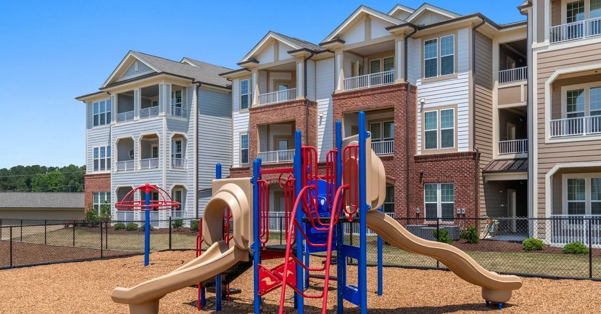
On the amenity side, the verified set at this address includes a heated indoor pool, a resort-style outdoor pool, a movie theatre room, a virtual reality room, a game room with billiards, a 24-hour fitness centre with a spin room, a sand volleyball court, a playground and an outdoor grill area. The heated indoor pool is the one that changes a Raleigh winter, and it is rare at this price anywhere in the metro.
Who east Raleigh genuinely suits
It suits anyone whose working day happens downtown, at WakeMed, or anywhere along the eastern corridor, because those are the commutes this geography is built for. It suits people who want outdoor space that is public rather than private, because the Neuse River Trail is a better long-term amenity than any courtyard. It suits households who would rather spend the difference between east and west Raleigh rent on something other than rent, and who are honest with themselves about driving to everything.
It does not suit someone who wants to live without a car, someone whose job or study is in RTP or on NC State's main campus, or someone who needs a walkable neighbourhood core. Those are not small objections and they are the reason this side of the city is cheaper. If none of them is disqualifying for you, east Raleigh is one of the better-value positions in the metro, and you can see current homes and pricing at The Villages at Raleigh Beach to put real numbers against it.
All drive times were measured with OSRM public routing on 5 October 2026 from 2015 Wave Crest Drive, Raleigh, NC 27610, with each destination snapped to its nearest routable road edge rather than its centroid. They describe typical conditions and will vary with traffic. All rents are bands as of 5 October 2026 and are listed base rents before any additional charges; pricing moves daily, so confirm current figures with the leasing office before relying on them.
Frequently asked questions
Is east Raleigh a good place to live?
It is a good place to live if you drive, work downtown or on the eastern side of the city, and value being near the Neuse River Greenway Trail more than being near a walkable high street. It is not a good place to live if you want a car-free life or your day happens in Research Triangle Park. The eastern wedge is large and varies street by street, so assess the specific block rather than the direction.
How far is the Neuse River Trail from The Villages at Raleigh Beach?
The trail corridor is about seven tenths of a mile from 2015 Wave Crest Drive in a straight line. The nearest routable point on the road network near Milburnie Park is a 0.93-mile drive, timed at 2.6 minutes by OSRM on 5 October 2026.
Can you walk to the Neuse River Trail from Wave Crest Drive?
We could not verify a walking route and will not claim one. The public routing engine used for every figure in this article has no separate pedestrian profile, so a stated walk time would really be a drive time relabelled. The straight-line distance is under a mile, which is walkable in principle, but you should walk the connection yourself before treating it as a feature of the address.
How long is the drive from east Raleigh to downtown Raleigh?
From 2015 Wave Crest Drive to Fayetteville Street in the centre of downtown is 5.75 miles and 12.2 minutes in typical conditions, measured with OSRM on 5 October 2026.
What neighbourhood is 2015 Wave Crest Drive in?
It depends who you ask, which is the honest answer. OpenStreetMap files the surrounding streets, including Raleigh Beach Road, under Wilders Grove. The property operator describes the address as Northeast Raleigh. The major listing portals place it within their East Raleigh neighbourhood boundary. The postcode is 27610.
Is east Raleigh the same thing as northeast Raleigh?
Not quite, and the overlap causes real confusion. Northeast Raleigh generally means the area around Capital Boulevard and Triangle Town Center, north of the Beltline. East Raleigh means the corridor running out along New Bern Avenue and Poole Road towards the Neuse River. Addresses near the boundary, including this one, get described both ways by different sources.
What do apartments in east Raleigh rent for?
Apartments.com reported an average of $1,336 for its East Raleigh neighbourhood, with a spread from the low nine hundreds to just under two thousand, as its search result read on 5 October 2026. At The Villages at Raleigh Beach, listed base rents as of 5 October 2026 ran from the high $1,100s for the smallest one-bedroom to the mid $1,600s for the largest two-bedroom.
Which highways serve east Raleigh?
I-440, the inner Beltline, is reached at New Bern Avenue, 2.23 miles and 4.3 minutes from Wave Crest Drive. I-540, the outer loop, is reached at Buffaloe Road, 6.23 miles and 11.7 minutes. I-87 and US 64 feed off the same interchanges and carry traffic east towards Knightdale, Zebulon and the coast. Figures measured with OSRM on 5 October 2026.
How far is NC State University from east Raleigh?
NC State's main campus routes at 9.13 miles and 18.2 minutes from 2015 Wave Crest Drive, measured with OSRM on 5 October 2026. It is a cross-town drive, not a local one, and it is the single strongest argument against this side of the city for students.
How long does it take to reach RDU airport from east Raleigh?
Raleigh-Durham International is 19.75 miles and about 30 minutes from 2015 Wave Crest Drive in typical conditions, measured with OSRM on 5 October 2026. East Raleigh is the wrong side of the city for frequent flyers, and that is a real cost to weigh against the rent.